Worth Every Step…All 16 Thousand of Them
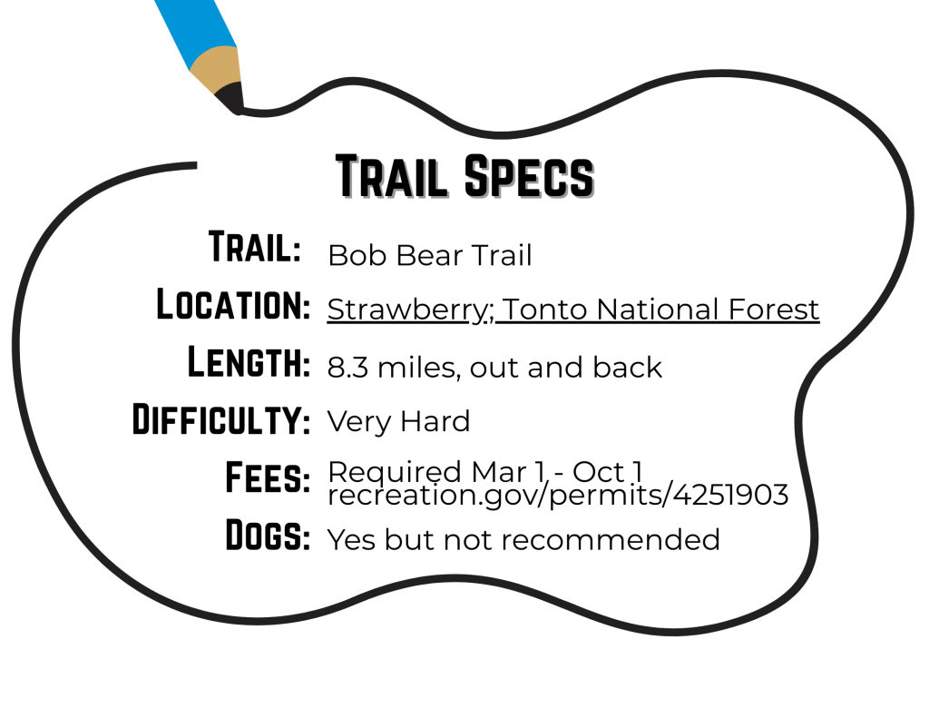
How To Get There
Bob Bear originates in Strawberry, AZ within the Fossil Springs Wilderness (near Payson). From Phoenix: head to the northeast section of the Valley and take the 87N — we usually take Shea through Fountain Hills. From Flagstaff, get to either the 260E or go south on Lake Mary Rd; both routes lead to the town of Strawberry, where then head west on Fossil Creek Rd.
The anticipation builds over the next 15 minutes as you drive through forested neighborhoods; for a little taste of tourism you can stop by the historic Strawberry Schoolhouse circa 1870. Once you are within 5 minutes of the trailhead, a Ranger will double check your permit and discuss trail specs. It will be a sorry day to drive all this way and denied at the entrance because your perm it is not printer (which does happen). Another tip: it is not a bad idea to check in on local weather/driving conditions beforehand by calling the Fossil Creek hotline: 928-226-4611.
Lastly, make sure you know where you are going: download this map of the area.
Where to Stay Near Fossil Springs (Bob Bear Trail)
Fossil Springs is one of those rare Arizona gems — crystal water, canyon walls, big adventure vibes. If you’re heading in from Strawberry or Pine and want to make a full weekend out of it, here’s a quick Vrbo link to browse places to stay nearby:
Note: This is an affiliate link. If you book through it, Opt Outside AZ may earn a small commission at no extra cost to you. Thanks for supporting trail snacks, gas money to Rim Country, and the never-ending quest for perfect swimming holes. 💚
A Debrief
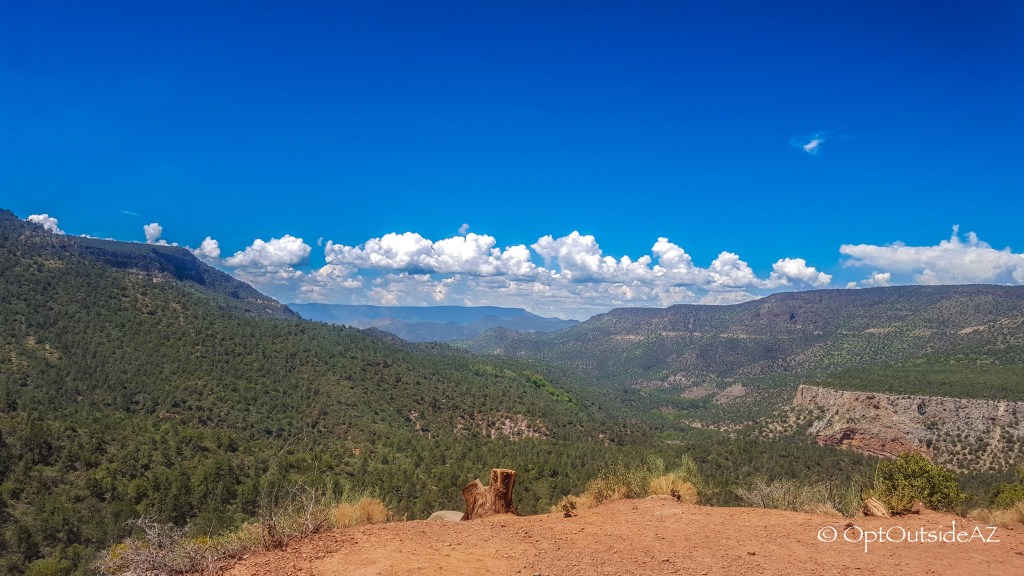
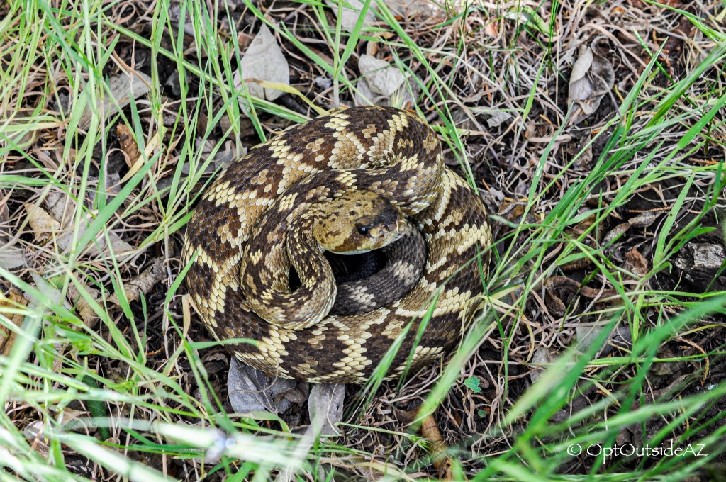
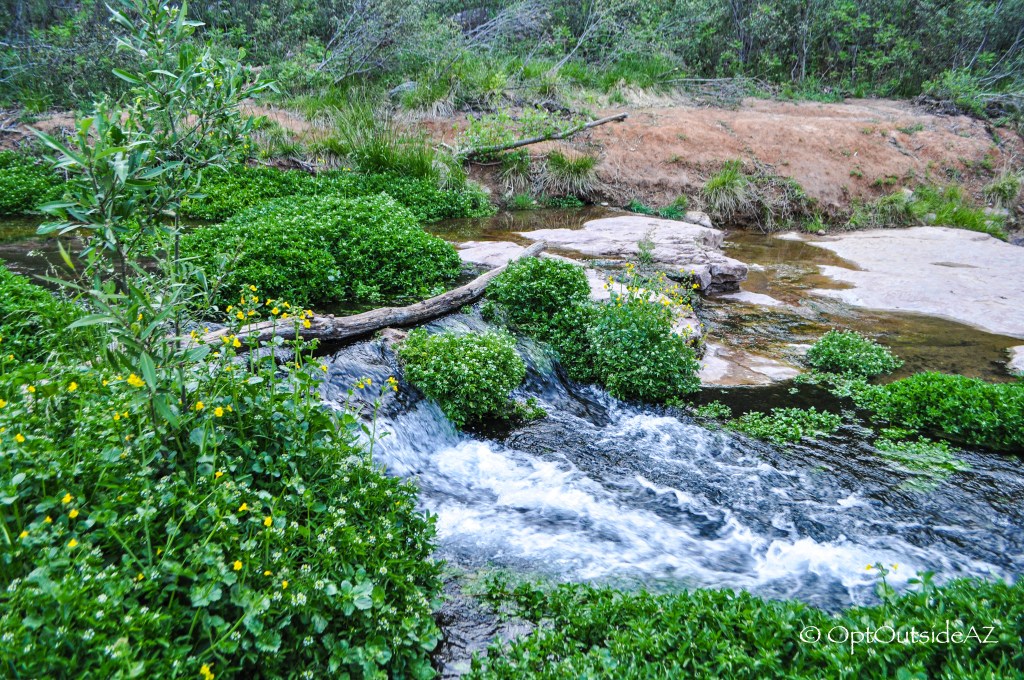
The Fossil Springs Wilderness is a beautiful backdrop to this trail filled with red rock, blue skies, various green trees and abundant flora throughout. Gladly, it is not extremely steep nor bouldery. But do not be mislead: Bob Bear is a difficult trail regardless of the time of the year. There are sections where loose gravel could mean a rolled ankle but aside from this, the true reason this is so challenging is because you must hike OUT 4ish miles after a day of playing in the water. With little tree cover for nearly the majority of the trek, this is a trail requiring a substantial amount of effort but with rewards of a glorious waterfall, several mini falls, rope swing havens, hidden caves, and refreshing water.
The Story of the Trail
The trail begins with a gradual descent and within 10 minutes, there is a flat area with a lone pine tree, and a glimpse into your future for the next few hours.
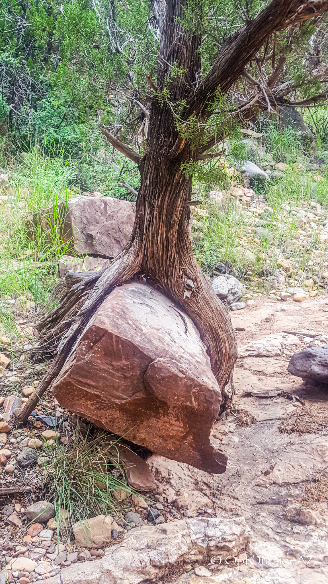
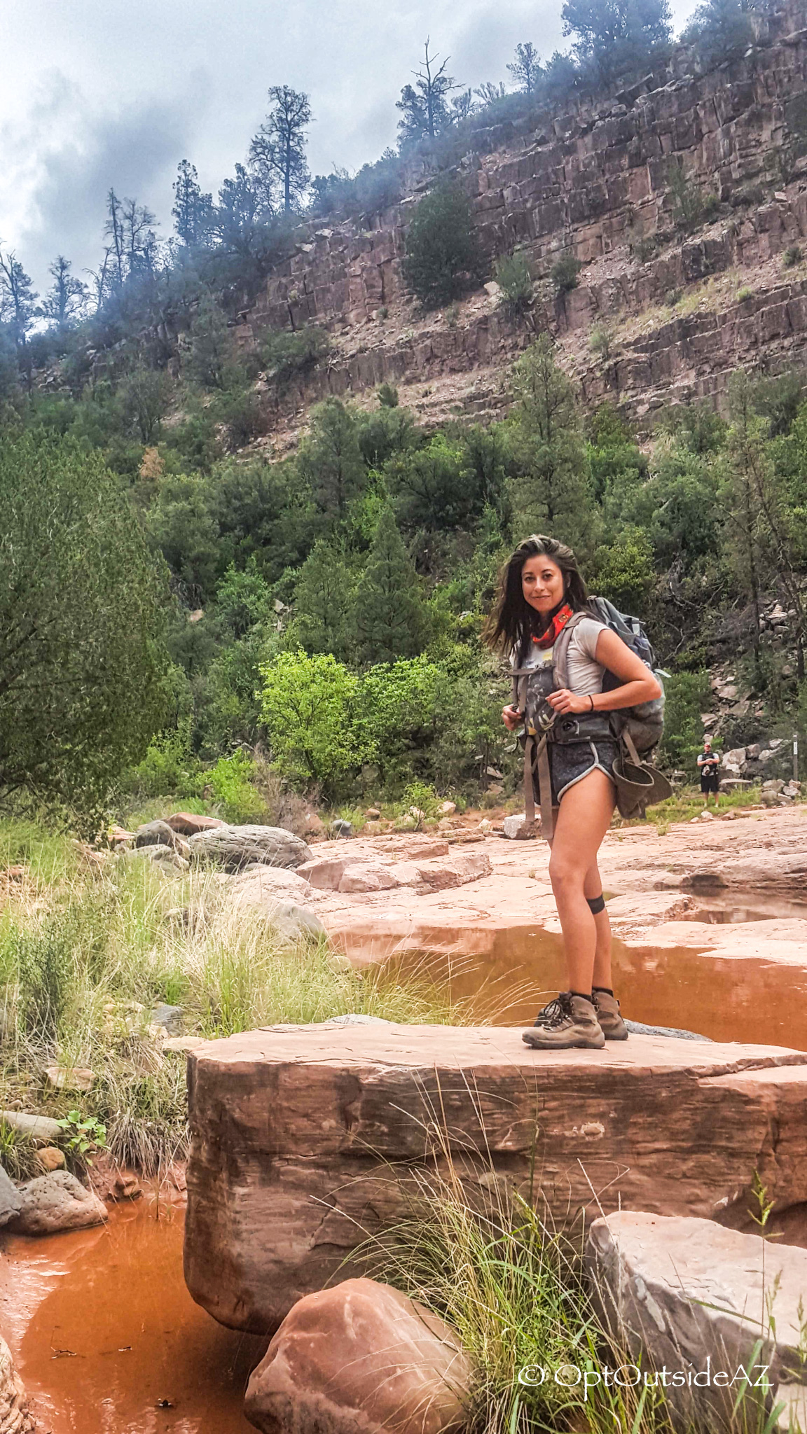
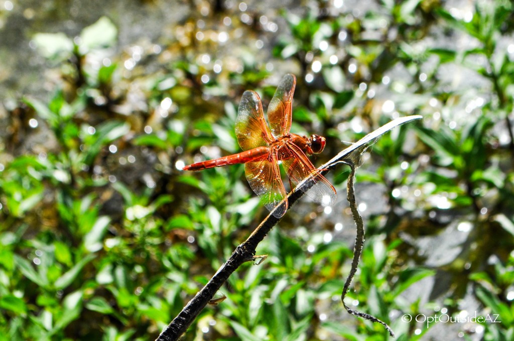
Although this hike is thick with vegetation, the majority is without much tree cover. SPF 30+, a hat, sunglasses, and hiking boots are standard gear for the hiker but check out my Gear List to help you get prepped for this hike (tennis shoes will let you feel every single rock so wear them with the correct expectation). Earth tones with diverse greens contrasting with the red oxidized stone, all sitting below a clear blue sky is the standard backdrop. As you wind alongside the mountain, each step is submerging one further into this green, luscious landscape. The only indication that there is a rushing body of water somewhere between these mountains is a sliver of bright green bursting from the lowest point where these mountains converge. The Arizona Sycamore, Fremont Cottonwood, and Arizona Alder are the likely culprits, and perhaps even the wild watercress that lounges atop the creek during the summer (edible and delicious!). High up on the trail, expect to be accompanied by Juniper trees, Pinyon Pines, Velvet Ash, Gambel Oak, Brittlebush, Manzanita, Creosote, Tonto Basin Agave, and many more high desert community plants.
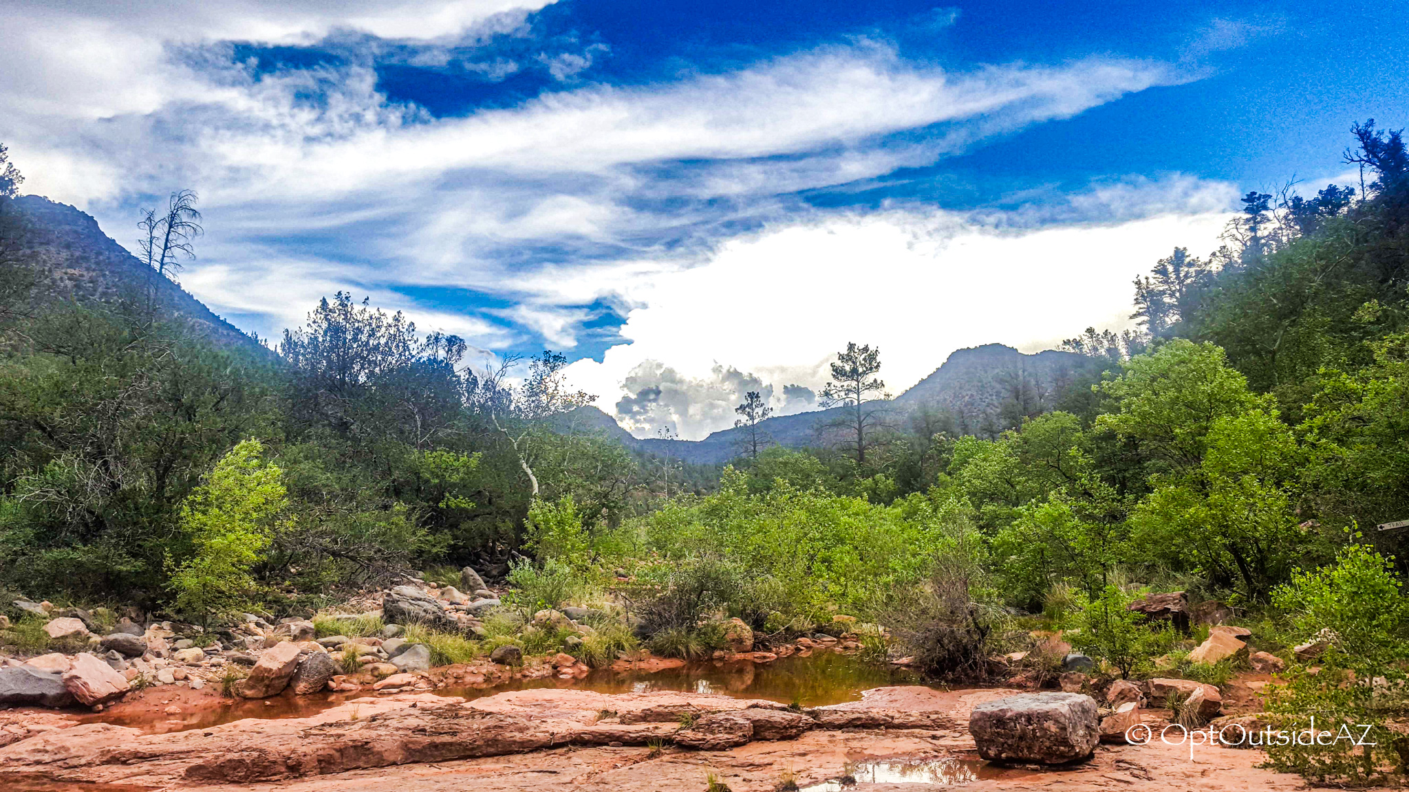
You are just beyond the halfway point when you arrive at the old Salt Lick, a level area that has been cleared out with a few places to rest under ample shade cover. This next trail segment requires one to be more sure-footed with loose gravel and steeper areas, a wrong move forecasting a rolled ankle and certainly a spoiled time at the creek. The final descent is about to start when you arrive at the Z gate…within 10 minutes the land levels out and the sounds of water can be faintly heard. You will feel the temperature change in this area, not just because the trees are overhead but also from the moisture in the air, soil, and vegetation. There will be the choice to take a right on the Mail Trail No. 84 or left – head left to finally encounter the creek.
Interesting note: this wilderness area is home to the Redwall Limestone, a geological wonder that creates jaw-dropping structures and filters Colorado Plateau water over hundreds of miles (dig in more here). It is also the one of the highest and most exposed layers of the Gran Canyon, to give you some perspective. It would make sense that Fossil Creek is likely named so because of this limestone presence, limestone forming from the calcium-rich skeletons of microscopic sea creatures, i.e. fossils.
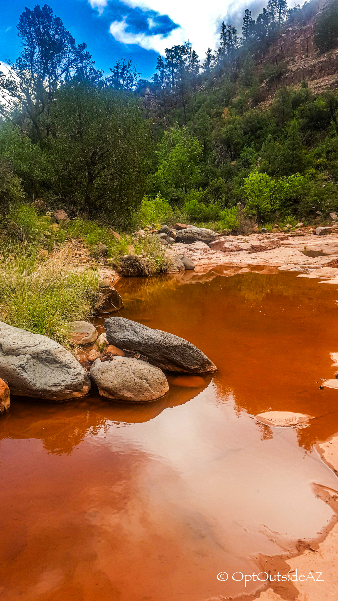
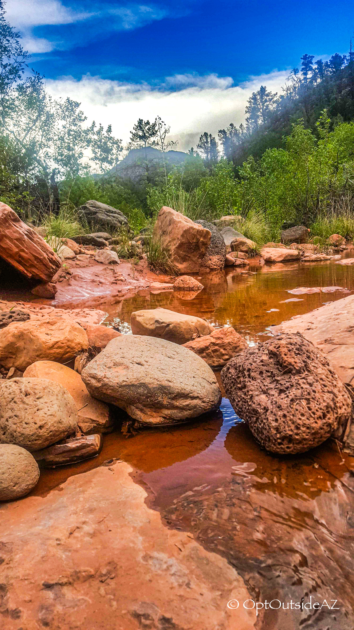
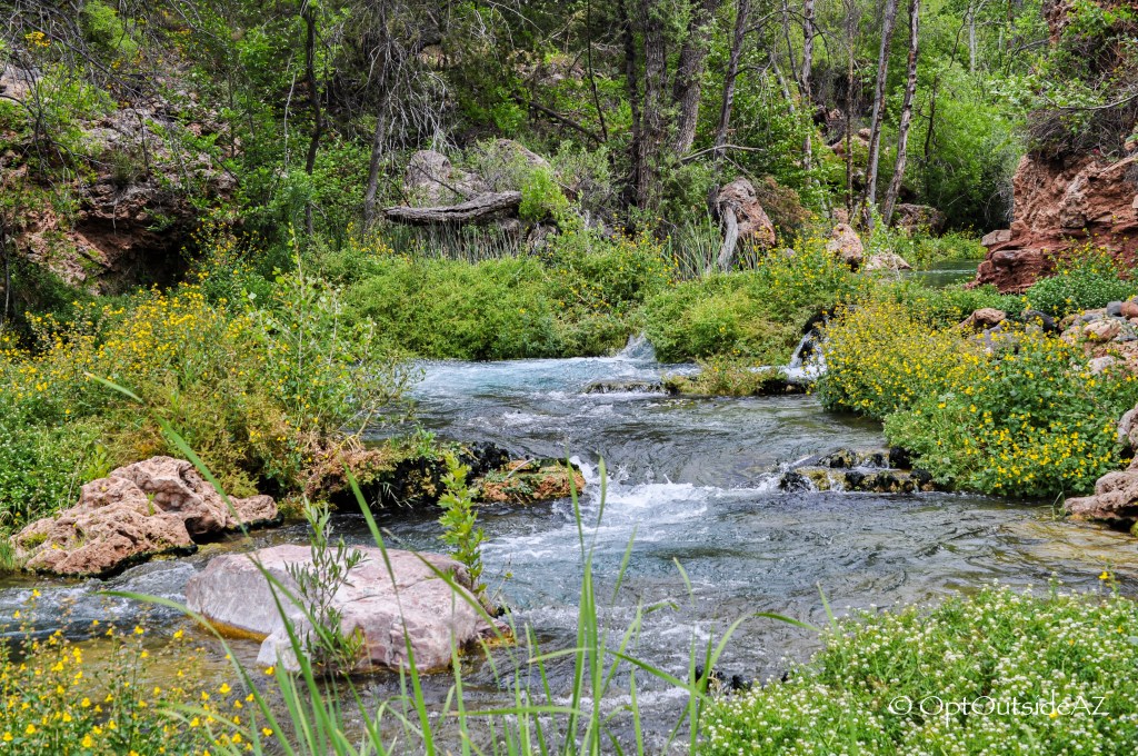
The Fossil Springs Wilderness is home to a unique travertine system created over time because of the calcium carbonate-rich spring waters. A beautiful sight to see, the now-minimal pools of water reflect the oranges of the travertine rock against the blues of the Arizona sky to create a dreamy setting. You can opt to stay on this side of the trail which is less frequented and thicker with untamed vegetation, or deviate from this path by walking across the travertine to another more established trail. Ten more minutes of easy walking in the shade of cottonwoods and conifers, you will come to a sign that directs you to either the Natural Spring or Waterfall. Head left toward the spring and you feel transported to a lush, desert jungle – yes, a desert jungle.
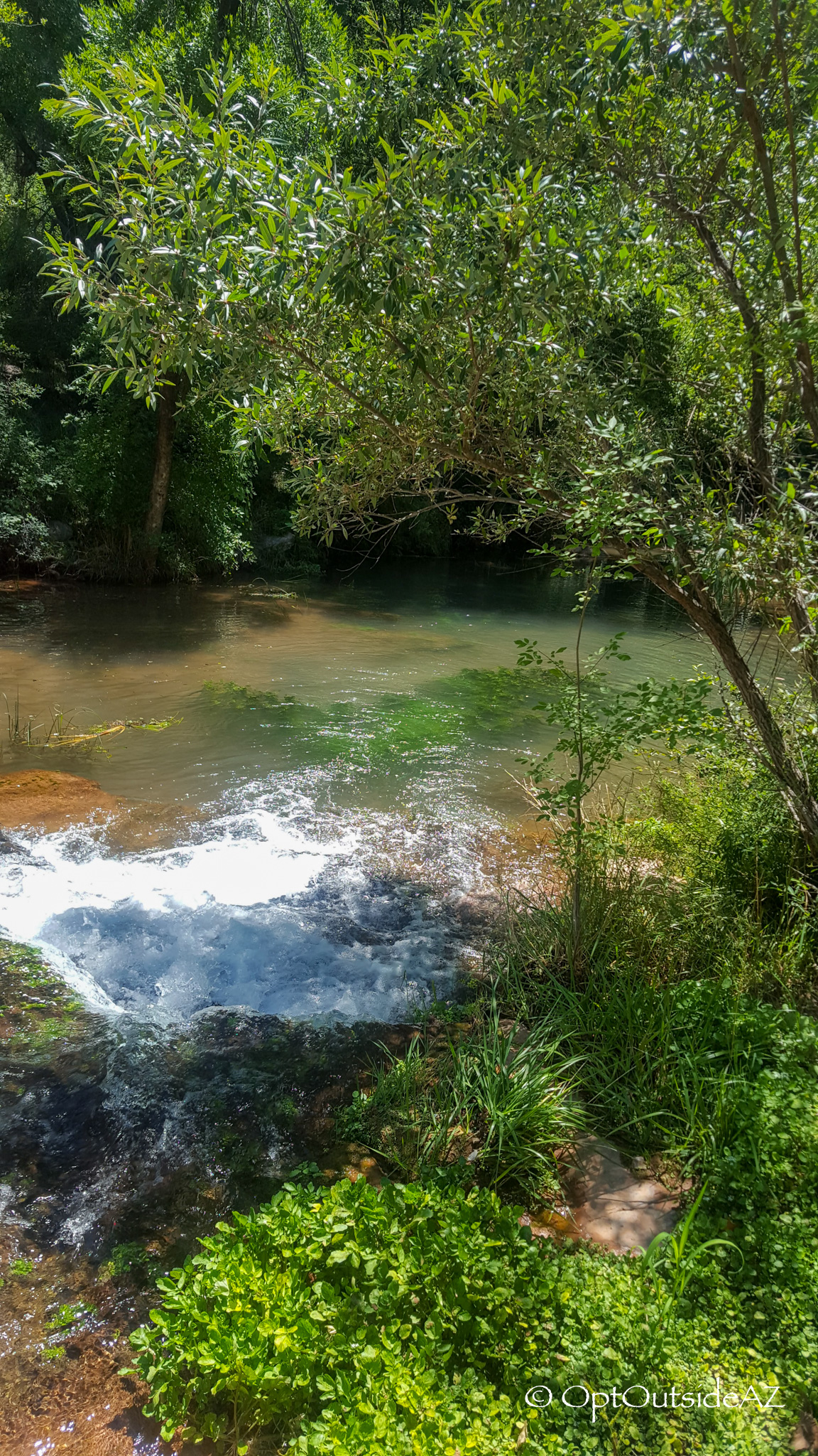
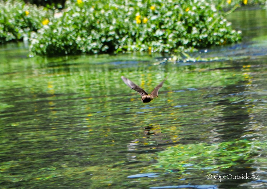
At the spring, you will see a constant gurgling of water as it shoots out of the rock from the ground, already filtered and ready to drink (at your own discretion). Head back to the fork in the trail and start the ascent, passing by a cleared out meadow with a few immense Alligator Juniper recognizable for bark reminiscent of gator skin. There are a few side-trails to the left which will bring you to a mini-waterfall and a large pool of calm water home to a few turtles and a historic rope-swing site. You can cross here again, or return to the meadow and take the high road toward the waterfall, which is my preference. The wildberry bushes are thick in this area and if you beat the animals and other hikers, you can get a taste of nature’s sweetness around the end of summer.
This side of the trail ascends to a higher elevation and out from under the tree canopy, revealing a birds-eye view of the Fossil Springs Wilderness in all it’s glory. After climbing up the side mountain and a slight descent, you will have arrived at the objective of this mission: that glorious waterfall.
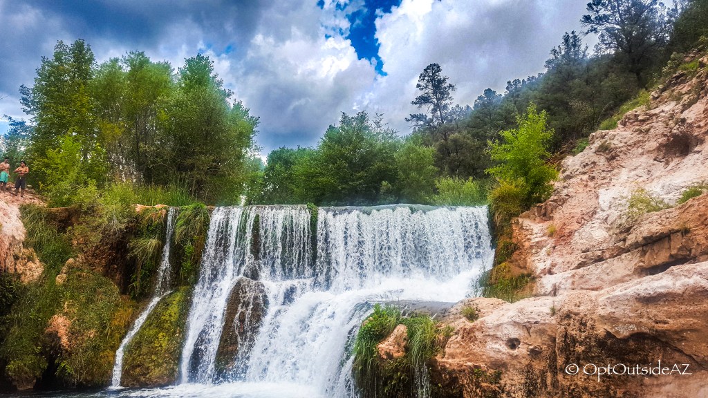
This is a powerful waterfall that once had a dam atop which harnessed hydroelectric power for local mining operations since 1912. It was in operation until 2005 due to nearly drying up this incredible water source. Since decommissioning and restoration, Fossil Creek has become one of two ‘Wild and Scenic Rivers’ in the state of Arizona which will secure its protection.
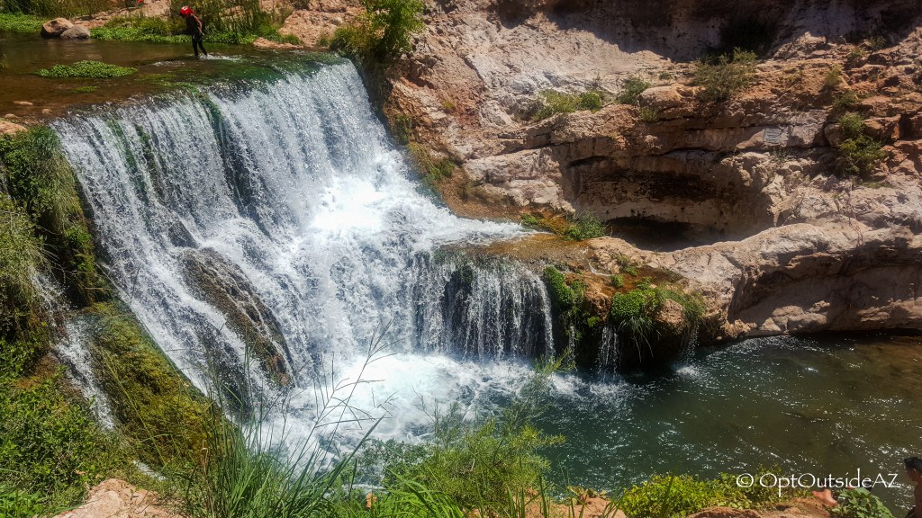
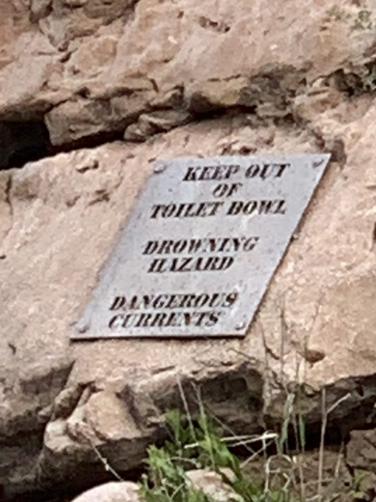
One side of the waterfall diverts to the primary channel of water while the other section hugging the mountain wall has carved out a grand recess, the constant rushing water chiseling a large hole into the stone to inevitably reconnect with the main waterway through an underwater hole. The grand recess I write about is commonly known as the Toilet Bowl, an aggressive version that spirals and flushes water, debris, people down through the hole. The Rangers no longer allow anyone to jump in here, and with good reason: people have died challenging the Toilet Bowl. Use good sense and don’t be a statistic. I hesitate to include the following info, but people will be people so I would rather give solid advice than assume everyone will heed the warnings. DISCLAIMER: we do not recommend anyone to jump into the Toilet Bowl.
- Make sure there is a rope tied to a stable rock in case you cannot swim to the underwater hole and need to climb out.
- Wear goggles.
- When you jump, commit. DO NOT bob back up for air – your weight will help carry you to the bottom and below the aggressive water, gravity bringing you to the submerged hole to swim through to the other side.
For those wanting to simply enjoy the water, climb gingerly down to the rock that regularly hosts a gaggle of people (ideal sunning and picnicking area) and set up camp there, or you can venture further. For the adventurous, swim against the waterfall’s strong current and to the left side to access a small, hidden grotto. Or perhaps climb up the rock wall and jump from heights of 10 or 15 feet. Or be a daredevil and brave a jump from the top of the waterfall. I estimate it is around 30ish feet high, yet this is not the only concern: there is a protruding rock near the bottom of the waterfall. The jump is doable but it is necessary to jump out as well. I particularly enjoy crossing the river at the top of the waterfall and scaling the opposite mountain face toward the Toilet Bowl. This area is admittedly steeper than most are comfortable with, but it is worth it to sit in the shallow pool dividing the waterfall and the Toilet Bowl…it is like sitting in a cold jacuzzi with a multitude of jet streams turned on at 110%.
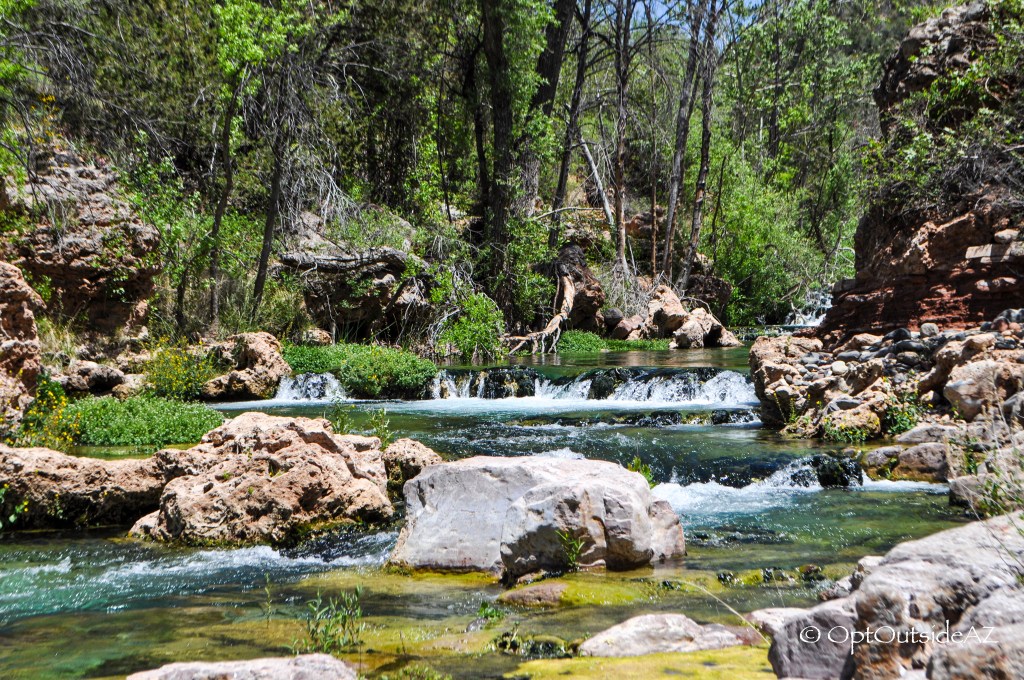
The waterfall continues into pools through a surging stream, dipping down and around a large boulder before widening into a channel and continuing downstream. To the left of the large boulder, there is a huge, dark cavern, perhaps 10 feet deep and 15 feet above water. What a treat! Calm water, privacy, and a bright blue light seemingly emanating from the clear water. I do not have good photos inside so this is simply a sight you must enjoy yourself! I do recommend continuing on the main trail beyond the waterfall — there are lots of unknown spots that are just as enjoyable. They just require a little searching; here’s a bit of what you can see:

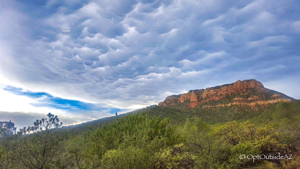
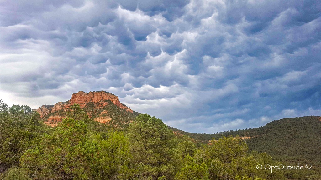
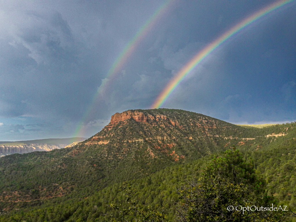
The way up is a steady grind. After the Z-gate, there are three major climbs before getting to the first overlook. During this trek we were gifted with a some of the most interesting cloud cover (perhaps mammatus clouds?). And fortunately for us, we were gifted a sweet sprinkle during the final 20 minutes of our hike as well as the most beautiful, defined rainbow we have ever seen! It was at our backs so imagine the surprise when turning around and seeing such an epic rainbow.
Supporting Local: Pinewood Tavern
Of course we were famished and we opted for PinewoodTavern, a happening bar-restaurant with live music. It was a busy Saturday night and we only waited for 15 minutes, all the while enjoying the live musical styling’s of 3 white-haired men singing in the tune of the Charlie Daniels Band. If you have any energy left, you can certainly find a dance partner here.
Ren Fou
MORE TRAIL READING


Something went wrong. Please refresh the page and/or try again.

Leave a Reply to An Arizona Swimming Hole: The Crack – OPTOUTSIDEAZ Cancel reply