
The One Overlook You Shouldn’t Skip in the Superstition Mountains
How To Get There
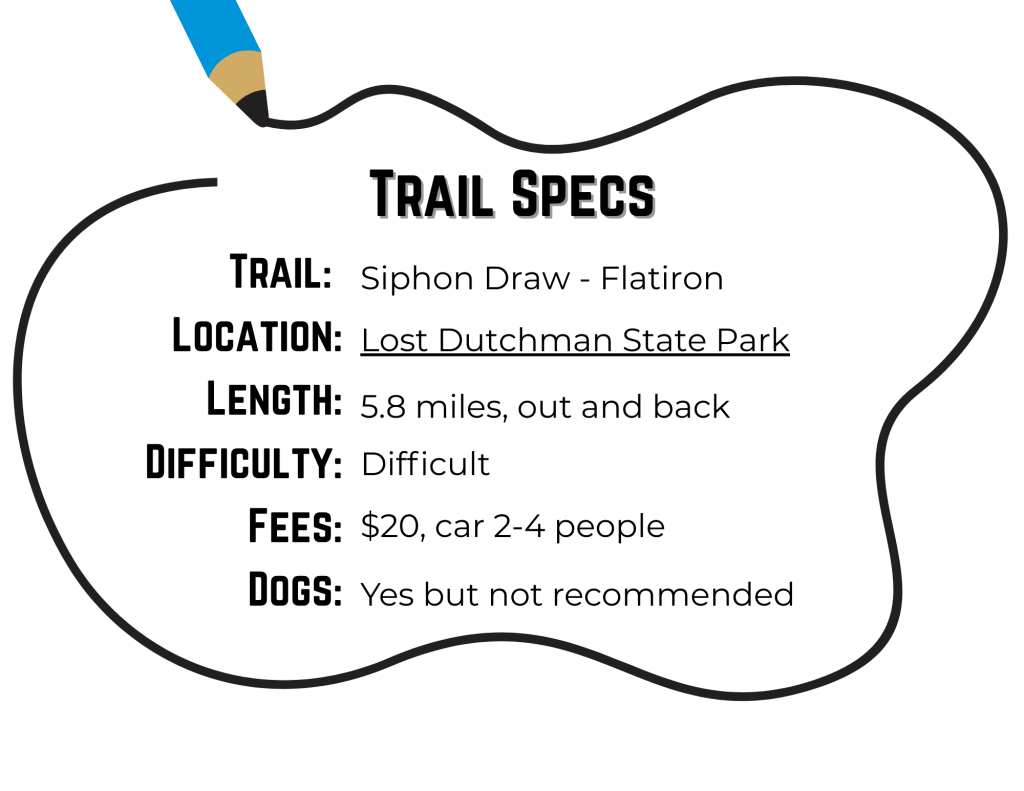
Drive toward Apache Junction on the US-60 and take Exit 298/Idaho Rd 88 North, heading to Lost Dutchman State Park. Take this road approximately 7.2 miles, passing Goldfield Ghost Town, and turning right at the entrance to the state park. Take the road heading to the right to locate the Siphon Draw parking lot for easy access to the Siphon Draw Trail.
Where to Stay Near the Flatiron (Superstition Mountains)
Doing Flatiron — especially from the lesser-known angles — is a whole journey: big climbs, bigger views, and a post-hike glow that hits extra. If you’re turning it into a sunrise mission or a full desert weekend, here’s a handy Vrbo link to browse stays near **Apache Junction, Lost Dutchman State Park, and the Superstitions**:
Note: This is an affiliate link. If you book through it, Opt Outside AZ may earn a small commission at no extra cost to you. Thanks for supporting trail snacks, topo maps, and sunrise summits. 💚
A Debrief
The best hike within 45 minutes of The Valley, hands down. This trail will challenge your body, mesmerize you with its beauty, reward your persistence… and absolutely test your fortitude. It’s nearly 3 miles up with a 2,681′ elevation gain, but don’t be fooled — that final mile is where most of the real work happens. Be prepared for actual climbing. And a pro tip that seems obvious but isn’t: don’t blow your load on the ascent. Save some energy for the trip down. I’ve had jelly-legs on the descent more than once.
Depending on where you park, you’ll either hop directly onto the Siphon Draw Trail (park at the Siphon Draw Lot), or you’ll tack on a warmup via Treasure Loop to Jacob’s Crosscut (parking at the Cholla or Saguaro Lots — this adds over two miles to your day) before connecting with Siphon Draw. Below is an older map of the park for reference.

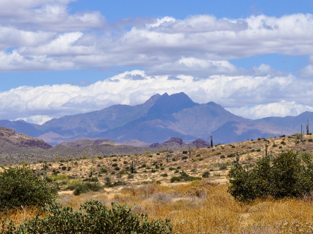
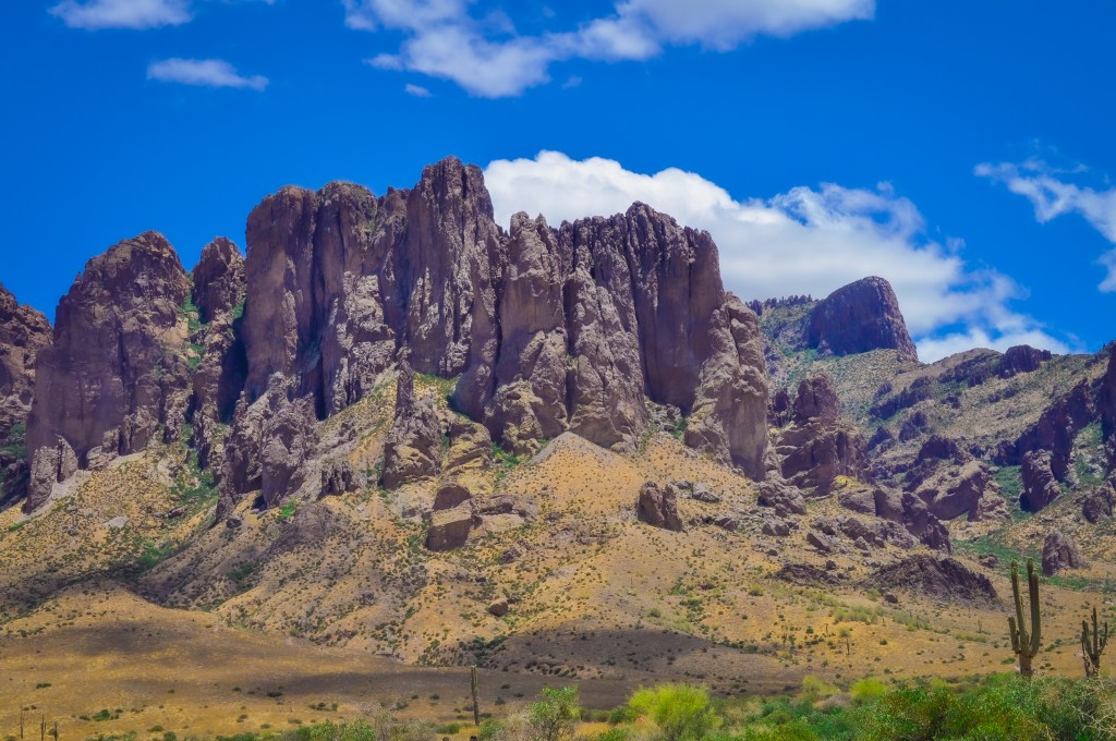
The beginning of the trail is smooth, flat, and friendly, dotted with low shrubs and cacti. Before you get too close to the mountain, glance northeast and you’ll see the Four Sisters (Four Peaks) watching over Tonto National Forest. The trees get fuller the farther you get into the mountain, and the red-oxidized cliffs loom above you — but they also give you some much-needed shade.

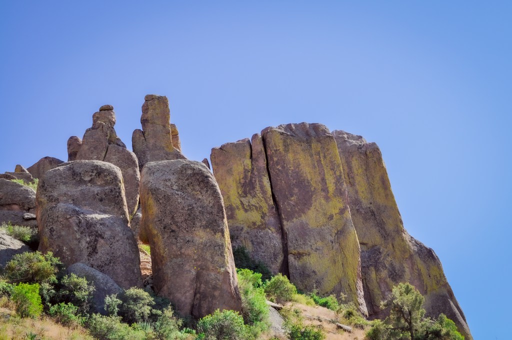

Siphon Draw eventually brings you to a slick, polished drainage chute — think Slide Rock State Park vibes, but without the water. This is where centuries of runoff have carved a smooth path down the mountain, which is how Siphon Draw got its name. It’s beautiful, but slippery, so take a diagonal line up for better traction.
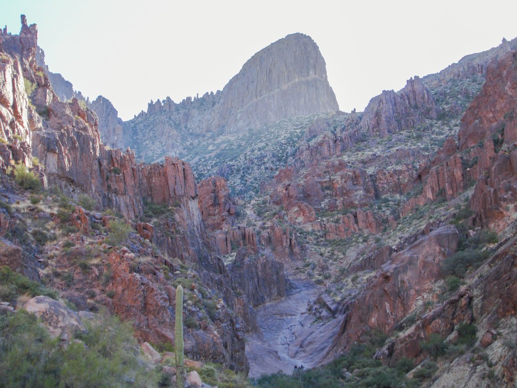
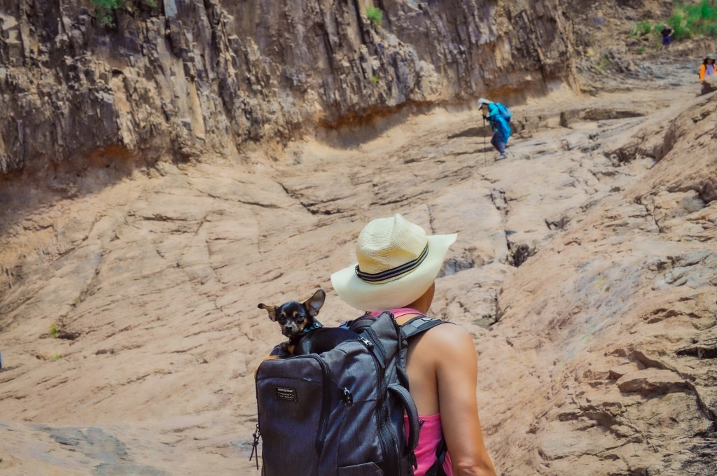

Just after this section, I want to note: I once saw a family of bighorn sheep on the north side of the mountain right here! Ok, moving on: it’s a steady quad-burner to the top. There are a few spicy sections where the trail gets sketchy, so pay attention to stay on trail. And yes, there are parts where you’ll use your hands — so if you brought a dog, you may need a helping hand to get them up the trail.
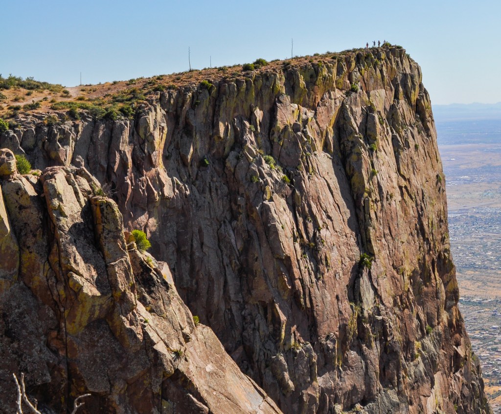
The ‘Secret’ Flatiron Overlook, Often Overlooked
It’s not actually a secret — just ignored. When you reach the final summit to the Flatiron, everyone instinctively heads to the right to rest atop the largest iron they’ve ever seen. But if you locate the trail heading to the left, it leads you to a stunning overlook on the north-facing side of the Superstitions.
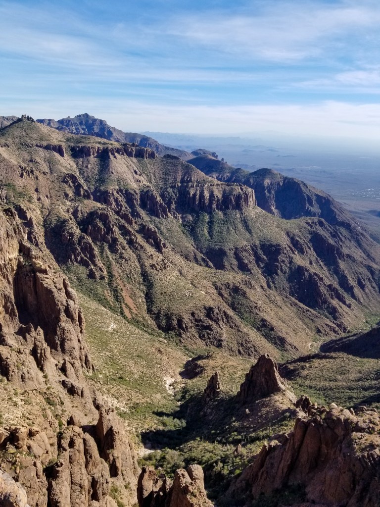
From here, you can see the beginning of Tonto National Forest stretching toward Payson and trace parts of the Apache Trail toward Roosevelt Lake. It’s remote, undeveloped, and quite the sight. There aren’t any established trails heading farther, so it’s a quick, rewarding side quest before heading toward the Flatiron.
There’s a lot more adventure up here. You can head up to Ironwood Peak, the highest point on the Flatiron, or keep trekking deeper into the Superstitions. Going farther opens up a whole world of wildness and beauty — but without time or backpacking gear, this is usually where the day ends.


There’s a lot more adventure up here. You can head up to Ironwood Peak, the highest point on the Flatiron, or keep trekking deeper into the Superstitions. Going further opens up a whole world of wildness and beauty — but without time or backpacking gear, this is usually where the day ends.


The Descent
The descent isn’t easy, but totally manageable if you’ve got sunlight and patience. If you start later in the day or know you’re someone who takes a lot of photos, bring a flashlight or headlamp with extra batteries.
Outside of recreation stores, I’ve purchased my last few headlamps from Harbor Freight and I genuinely like the Braun Rechargeable Headlamp — good quality, durable and does not require batteries. One of my worst yet most preventable hiking memories was forgetting to replace the near-dead batteries in my headlamp, only realizing it as the sun officially set whilst I began the final leg of the Ridgeline Trail — a.k.a. the Death March. That’s a tale for another day (I discuss this a little in my Day Trip Gear List article), but simply remember to always check your headlamp battery situation before a long hike.
Now…get your hike on!
Ren Fou
MORE TRAIL READING


Something went wrong. Please refresh the page and/or try again.

Leave a Reply to The Essential Day Trip Gear Checklist – OPTOUTSIDEAZ Cancel reply